Learn how to accurately measure the height between two points in VoidMapper. This functionality is essential for tasks such as assessing elevations, determining differences in terrain, or evaluating structural features.
1. Find the tools.
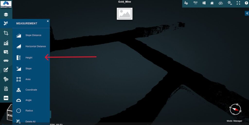
When previewing a point cloud dataset, click on the measurement tool. It is the compass icon found on the left tools sidebar. This will display the different options you have to make measurements.

2. Select “Height”.
Click on the Main Site A team.
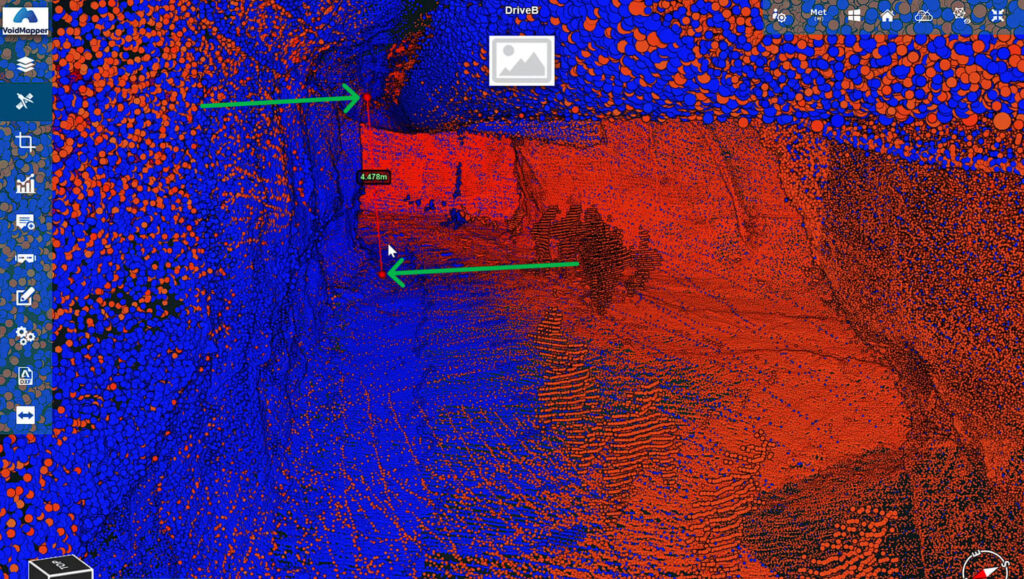
3. Draw Points & Measure.
Measure by clicking between two points in the dataset to create Points A & B. The height will be displayed between these two points.